.png)
SoftwareHope AI Copilot
Grounded in verified SoftwareHope indexes
Grounded in verified SoftwareHope indexes
Premium directory of the weather apps & services market. We've vetted 19 top-tier solutions to streamline your selection process.


Showing 19 results
Weather.gov is the public-facing portal of the US National Weather Service providing official government weather forecasts; severe weather watches and warnings; radar imagery; and specialized products for aviation; marine; fire; and agricultural users. It is the most authoritative and transparent source of weather information for all US territories; entirely free and publicly funded.

Windy is a professional-grade weather visualization platform delivering real-time animated maps of wind; rain; temperature; ocean swells; and air quality for any location on Earth. It is widely trusted by pilots; sailors; paragliders; storm chasers; and weather enthusiasts for its accuracy and depth of atmospheric data.
The Met Office is the United Kingdom's national meteorological service providing scientifically rigorous weather forecasts; climate projections; aviation weather; marine services; and space weather monitoring. Its globally respected atmospheric modeling capabilities make it a trusted source for both public forecasting and high-stakes professional applications across government and industry.

Ventusky is a weather visualization platform delivering stunning real-time animated maps of wind; rain; temperature; pressure; humidity; and other atmospheric parameters for any location on Earth. It is designed to make complex meteorological data visually intuitive and accessible to both general users and weather enthusiasts without requiring technical expertise.
SAT24 is a dedicated real-time satellite imagery platform providing high-resolution visible; infrared; and nighttime cloud views for Europe and global regions updated every five minutes. It is particularly valued by weather enthusiasts and professionals for tracking storm systems; fog development; and large-scale atmospheric patterns through live satellite data.

The India Meteorological Department is the official government meteorological agency of India responsible for weather observation; forecasting; and seismology across the entire subcontinent. It provides critical services including monsoon forecasts; cyclone alerts; heat wave warnings; and agricultural weather advisories for over a billion people.

AccuWeather is a globally trusted weather platform serving over 1.5 billion users daily with hyper-local forecasts; severe weather alerts; and a 15-day outlook. It combines advanced meteorological science with consumer-friendly tools for everyday planning and emergency preparedness.

Foreca is a Finnish weather platform delivering accurate; clean; and highly customizable weather forecasts through a straightforward three-view interface covering daily; hourly; and graph-based meteorological data. It is widely praised for its forecast precision; lightweight design; and a responsive developer team that actively incorporates user feedback into ongoing improvements.
The Weather Channel is one of the world's most widely used weather platforms offering hourly; 10-day; and severe weather forecasts alongside air quality and pollen index data. It combines broadcast-quality meteorological content with powerful digital tools for storm tracking and daily planning.

Weather Underground is a hyperlocal weather platform that aggregates data from a massive global network of personal weather stations to deliver street-level forecast accuracy. It also provides high-resolution GOES-16 satellite imagery; historical weather data; and customizable alerts for informed daily planning.
RadarScope is a professional-grade radar application designed for storm chasers; meteorologists; and serious weather enthusiasts requiring uncompromised radar data quality. It accesses raw NEXRAD Level II feeds with dual-polarization products capable of distinguishing rain; hail; and tornado debris; supported by a 30-year historical archive and atmospheric sounding data for deep scientific analysis.
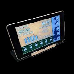
WhatWeather.today is a modern weather platform integrating multiple meteorological data sources into ensemble forecast models for improved accuracy and reliability. It offers 15-day extended outlooks; customizable severe weather alerts; both visible and infrared satellite imagery; and API integration capabilities for developers and business applications.

Meteoblue is a Swiss academic-origin weather platform delivering professional-grade forecast data; historical climate records; and advanced model comparison tools to users worldwide. Founded as a University of Basel spinoff; it uniquely serves researchers; farmers; outdoor professionals; and weather enthusiasts with scientifically rigorous atmospheric data and 86 years of ERA5 historical reanalysis.

The Weather Network is Canada's leading weather platform delivering localized forecasts; severe weather alerts; and rich multimedia meteorological content for all Canadian provinces and territories. It combines professional meteorologist videos; community observations; and detailed winter weather tracking to serve both everyday users and weather-sensitive industries across North America.

SpaceWeather.com is a specialized daily-updated publication tracking solar activity; space weather events; and their terrestrial impacts including aurora forecasts; geomagnetic storm alerts; and radio blackout warnings. It serves aurora chasers; amateur radio operators; satellite professionals; and scientifically curious users seeking accessible coverage of solar cycle activity and space environment conditions.

NOAA's National Weather Service is the official US government meteorological agency providing authoritative forecasts; warnings; and weather data for all US territories and coastal waters. It serves the public; aviation; marine; fire weather; and agricultural sectors through a nationwide network of forecast offices and observing systems.

World Weather Online is an international weather forecast service delivering detailed 12-day outlooks for thousands of locations globally; updated four times per day. It features interactive weather maps; live observation overlays; 3-hourly breakdown pages; and marine weather data useful for travelers; researchers; and outdoor planners.

The World Weather Information Service is an international weather portal operated by the World Meteorological Organization aggregating official city forecasts from national meteorological agencies across 183 countries and territories. It provides travelers; researchers; and international users with authoritative government-sourced weather data for major urban centers worldwide in multiple languages.

OpenWeatherMap is a globally used weather data and API platform providing current conditions; short and long-range forecasts; historical records; and air pollution data for over 200;000 locations worldwide. It serves developers; data scientists; and businesses seeking reliable; scalable weather data integration for applications across industries.